
Product
Handheld 360° Image Kit for Hovermap
Augment Hovermap point cloud scans
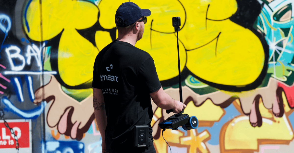
Augment your Hovermap point cloud scans with 360° panoramic imagery to add extra contextual information and derive new insights. The 360° camera attaches directly to the Hovermap unit and is designed to comfortably hold in one hand, enabling easy capture of panoramic images and 3D LiDAR data at the same time.
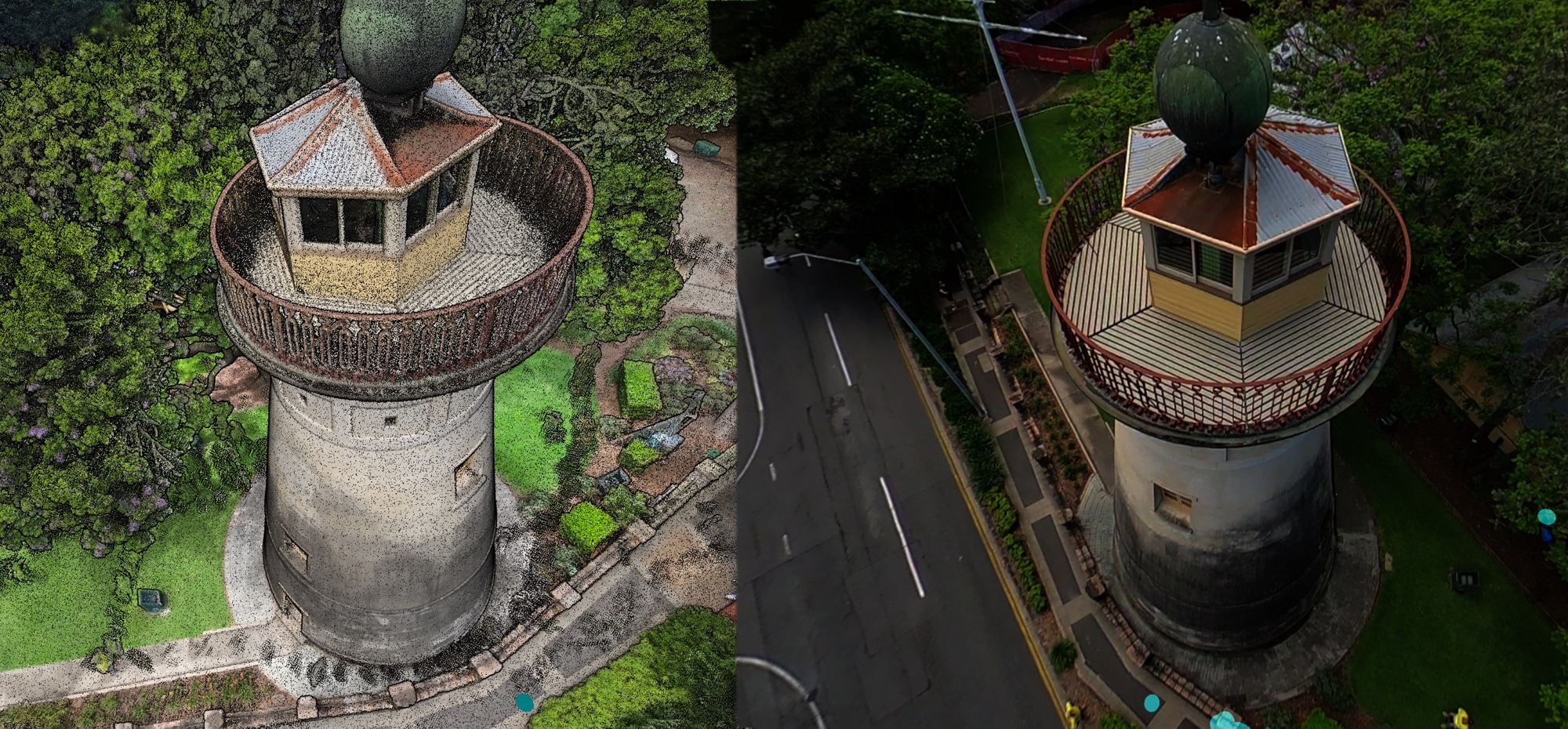
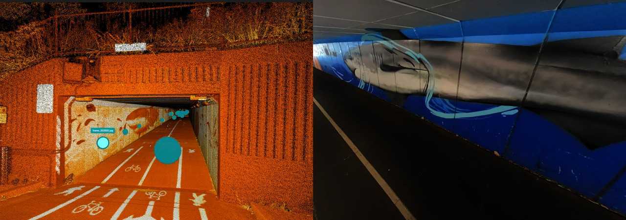
During processing in Aura, the 360 images are automatically registered to the point cloud without the need for calibration, streamlining workflows. The aligned images and LiDAR point cloud data can then be displayed in Aura or exported into third-party platforms including Pointerra, Cintoo, Bentley, and Prevu3D.
Benefit from:

Accelerated workflow with streamlined registration and export of 360 photography that has been captured alongside Hovermap.


Where to use the Handheld 360 Image Kit
Where to use the Handheld 360 Image Kit
WHAT’S IN THE KIT?
WHAT’S IN THE KIT?
Emesent Products
Payloads
Accessories
Robotics platforms
Testimonial

Features
Automated registration
360 images automatically appear in the correct location on the point cloud ready for visualization.
No calibration required
Aura automatically selects and applies the correct orientation settings for use with the telescopic mount.
Image masking
Option to mask out the operator using a default mask, or create your own.
Supports custom hardware mounts
Use the same 360 camera on your own custom mount on other platforms such as a vehicle or drone.
Orientation override
Override the default when the camera is custom-mounted to ensure images are correctly registered during processing.
Configurable extract frequency
Configure how frequently the image is extracted from the 360 video.
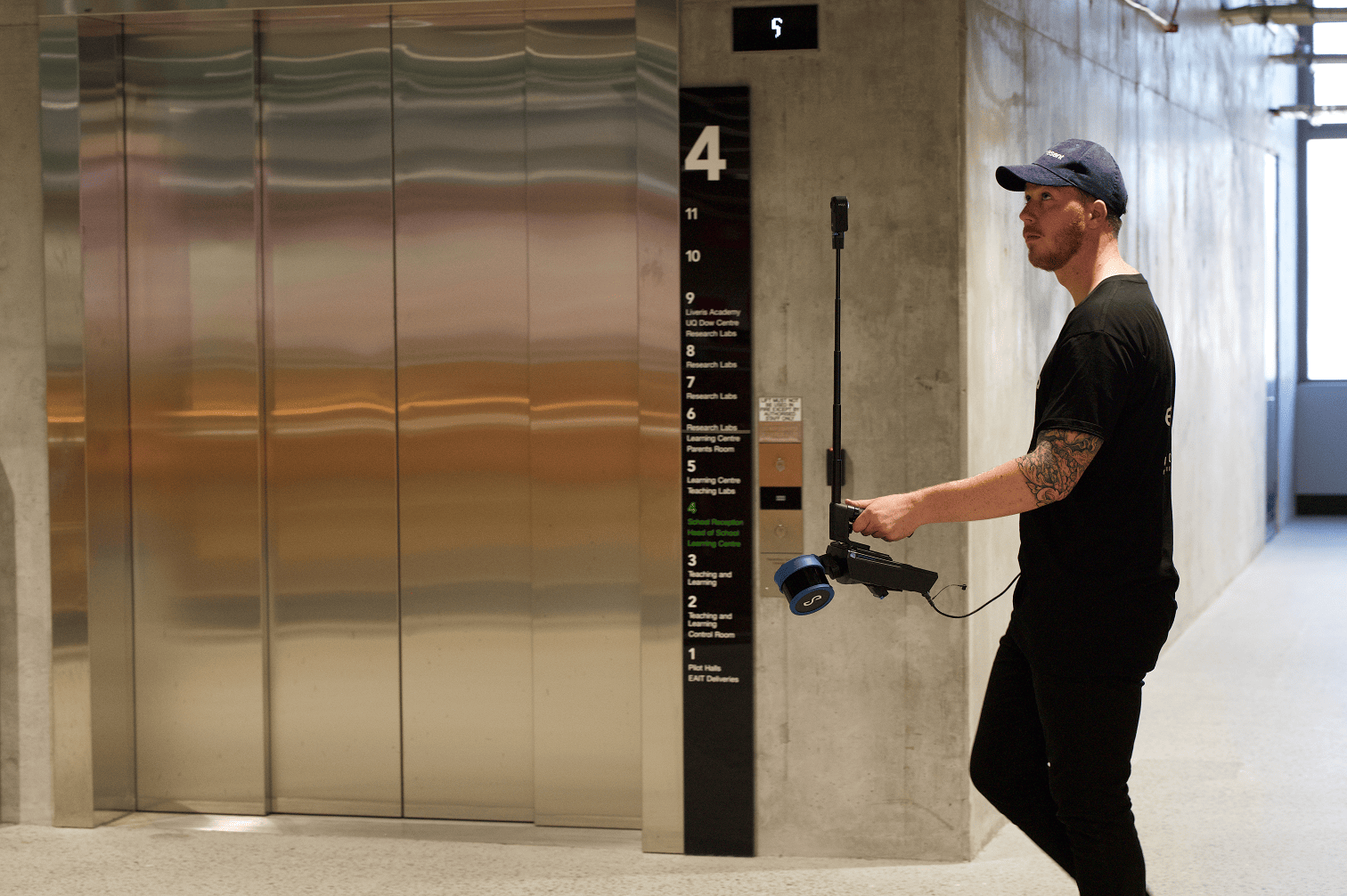
One-handed data capture
Comfortably hold and operate the combined Hovermap and 360 camera unit with one hand.
Unobstructed data capture
Minimized image obstruction by people and equipment.
Frequently Asked Questions
Ultimately, integrating 360° imagery helps reduce ambiguity, minimizes the need for site revisits, and ensures that critical visual details are preserved and accessible throughout the project lifecycle.
Yes. To combine 360° imagery and Hovermap LiDAR data for construction progress monitoring, capture data at regular intervals throughout the project simply by attaching the handheld 360 image kit to Hovermap and walking the area.
The LiDAR data provides precise 3D measurements and spatial geometry of the site, while 360° images provide rich visual context. Emesent Aura will automatically georeference or align the 360 images with the point cloud without the need for calibration. This allows stakeholders to virtually walk the site, inspect specific elements in detail, and compare progress over time using both measurable data and photo-realistic visuals. The combination enables accurate tracking of installation progress, verification of work against design models, issue identification, and better communication among field and office teams.
360° images enhance the point cloud by providing photographic context and enabling detailed visual focus. This makes it easier for stakeholders – especially those unfamiliar with interpreting point clouds – to understand what has been captured, even without prior knowledge of the scanned environment.