
Product
Emesent Aura
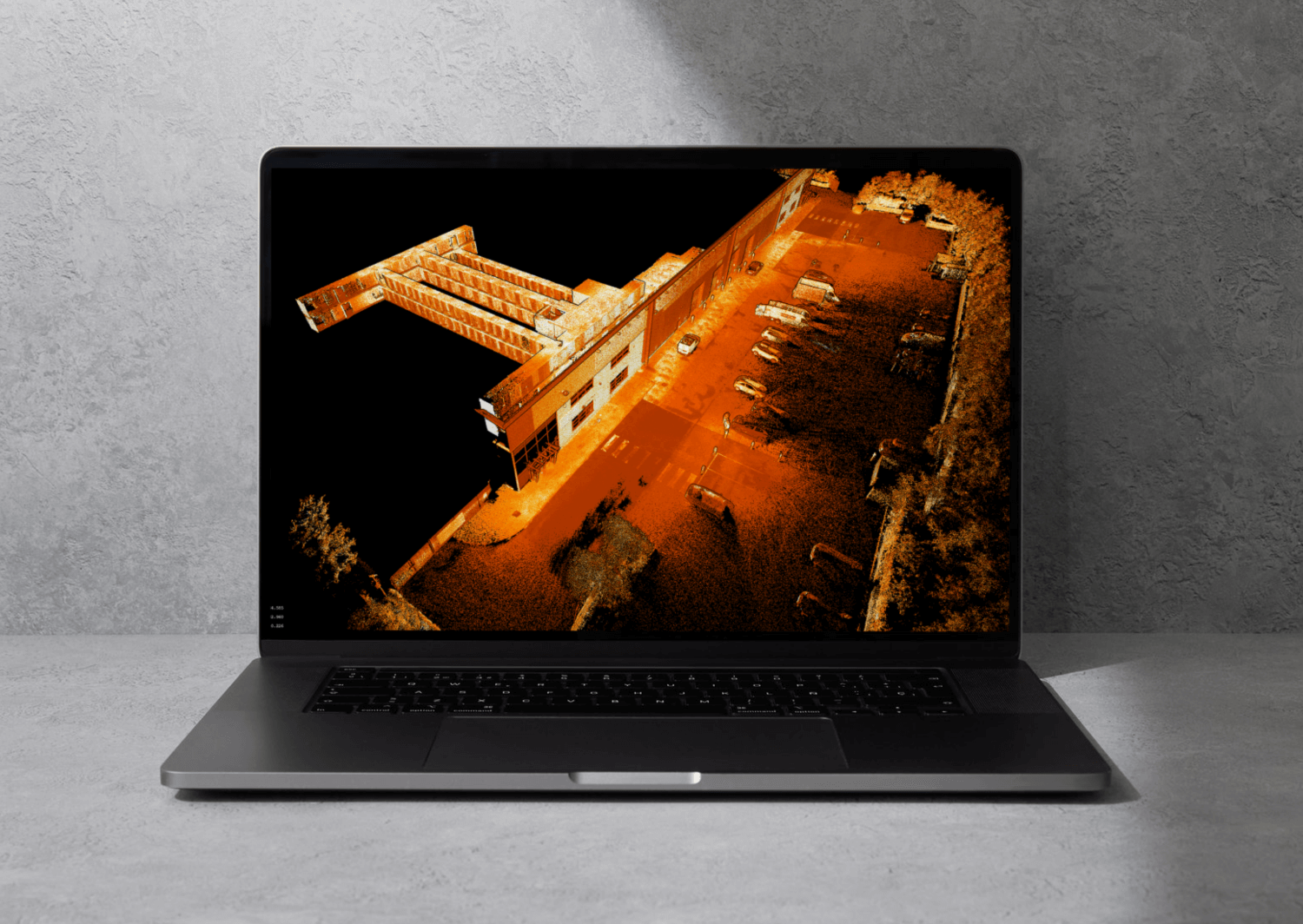
Unlock the power of your Hovermap point clouds
Experience the next generation Emesent Aura — the all-in-one processing and visualization platform that takes your Hovermap scans to the next level. Whether you’re capturing data via drone, handheld, backpack, vehicle, or any combination, Aura streamlines your entire workflow.
Built with the flexibility and versatility you expect from Hovermap, Aura makes point cloud processing and visualization faster and easier than ever. Powerful automation, intelligent filtering, and advanced point cloud enhancement tools deliver precise, high-quality results with speed and ease.
Transform how you process, view, and analyze point clouds — all in one powerful, intuitive platform.
Why use Aura?


Aura lets you use your own control targets, reuse existing ones or use Emesent’s own, as well as process and visualize scans from any capture method – with the same flexibility and versatility that make Hovermap stand out.
Emesent Products
Payloads
Accessories
Robotics platforms
Transform how you process, view and analyze point clouds
Reliable, high quality processing powered by the world’s leading SLAM algorithm converts your data into highly detailed, accurate point clouds, with a range of flexible, easy to use features that improve accuracy and enhance visualization.
Optimized Accuracy
Aura takes the pain out of georeferencing with smart, automated tools that boost the accuracy of your Hovermap scans and optimize SLAM results – fast, seamless, and hassle-free.
- Automated georeferencing & drift correction – No more manual GPS entry or time-consuming adjustments, saving you hours and reducing errors.
- Effortless scan alignment – Merge and align multiple scans with minimal manual intervention to create a complete, precise view.
- Non-rigid merge – Seamlessly combine multiple point clouds into one consistent, high-quality dataset.
- High-precision RTK for above-ground scans – Achieve centimeter-level accuracy at the click of a button, cutting down the need for physical ground control points and speeding up project delivery.
- Verified results – Checkpoints and error reporting let you verify every detail, while shareable accuracy reports give you and your clients full confidence in the final output.

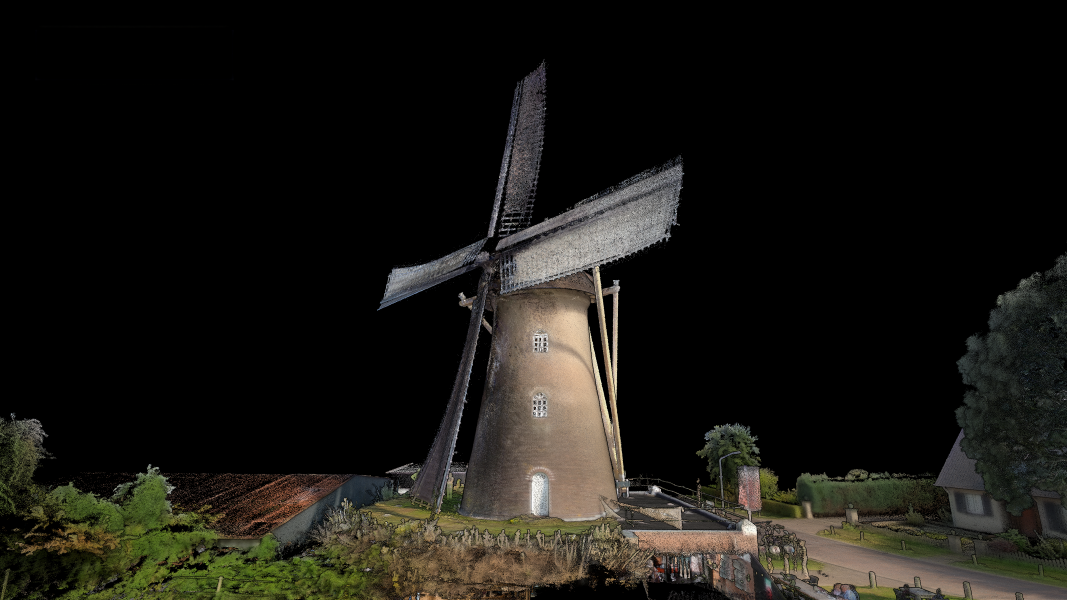
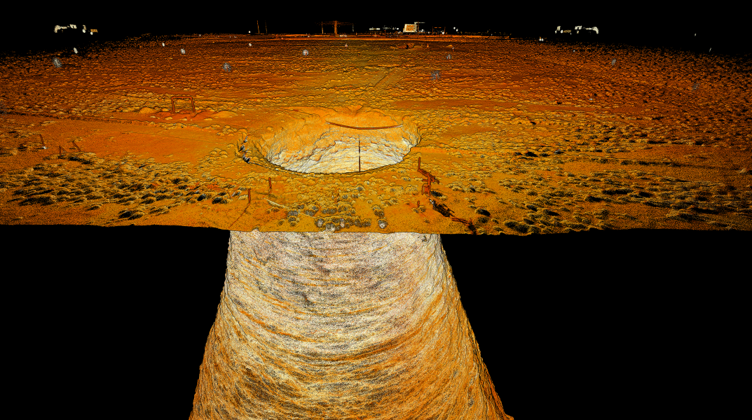
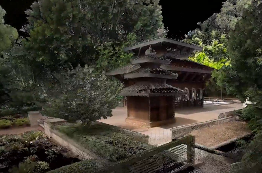
Enhanced Visualization
Bring your point clouds to life in exceptional detail with advanced visualization features that automatically clean and optimize your datasets to deliver exceptional clarity.
- 360° colorization* – Enhance point cloud realism with vivid, true-to-life colorization that makes interpreting scanned features effortless
- 360° panoramic images* – Seamlessly capture, register, and export immersive 360° panoramic photos for enhanced visual context and analysis
- Color scale filtering – Highlight key attributes like elevation, intensity, time and range
- Change detection and convergence monitoring – Provides a powerful tool for tracking environmental changes with ease for underground applications (optional).

Flexibility to suit you
Bring your point clouds to life in exceptional detail with advanced visualization features that automatically clean and optimize your datasets to deliver exceptional clarity.
- Unlimited processing – No hidden processing fees – your license includes unlimited processing with no square meter (sqm) usage restrictions.
- Multi-user access – Allows licenses to be shared across multiple team members in different locations and on multiple devices.
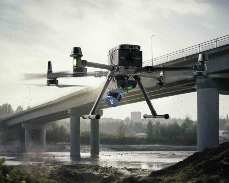
- Multi-capture processing – Whether your scans are captured handheld, on a backpack, drone, vehicle, or a combination, Aura processes and visualizes your data with ease.
- Use your own targets – Choose any identifiable feature in the point cloud to speed up your workflow or add Emesent’s retroreflective targets, automatically detected to provide extra location data points.

See the full list of Aura features
Watch the Aura overview
“I found the interface to be super intuitive and the display of all control points’ error is very much appreciated.
I especially like how you can see the rigid control error before you “commit” to running the longer SLAM GCP adjustments.”
Frequently Asked Questions
No matter how dense your point clouds or complex your 3D structures are, Emesent Aura allows you to process, view, clean, georeference, validate accuracy and take measurements from Emesent Hovermap point clouds in a single streamlined application.
Aura lets you automate previously manual and error-prone tasks to improve the quality of analysis and optimise scanning results for better decision-making.
Aura excels at displaying the dense, highly detailed point clouds created by Hovermap, even for extremely large datasets featuring billions of individual points.
Aura’s seamless multi-user licensing can easily be shared between colleagues in different locations and on multiple machines.
Emesent Aura’s Automated Ground Control enhances the capabilities of SLAM-based mapping. During processing, Automated Ground Control detects the reflective ground control targets and uses these to georeference the point cloud while improving accuracy.
In addition, Aura has the flexibility to use any targets which can be identified and picked in the point cloud, such as checkerboard targets and paint marks, speeding up time required on site and removing the need to return to site.
Ground Control is an Emesent Aura extension that requires an additional license. Emesent Ground Control targets (sold separately) are required in use with Automated Ground Control.
Contact us for more information.
Emesent Aura’s Colorization offers a new dimension of reality capture to 3D point clouds for deeper environmental insights, providing additional context, more clarity and heightened realism. Colorization is an Emesent Aura extension that requires an additional license. You will also need a rugged action camera attached to your Hovermap. Contact us for more information.
Currently, Emesent Aura’s RTK supports Hovermap scans on the DJI M300 and M350 drones.
Existing User? Contact us to get your Emesent Account set up.